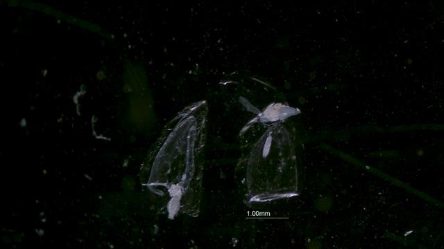
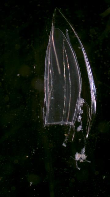
Species Detail - Muggiaea atlantica - Species information displayed is based on all datasets.
Terrestrial Map - 10km
Citation: National Biodiversity Data Centre, Ireland, Muggiaea atlantica, image, accessed 07 July 2026, https://maps.biodiversityireland.ie/Species/TerrestrialDistributionMapPrintSize/16164
To add this map to your own website, copy and paste the code shown below to your site's HTML. To customise the size of
the map you may change either the width or the height attributes to a specific size in pixels i.e. height="250px".
Do not however change both width and height since you may distort the map. Simply change either width or height and the map
will then automatically scale to the correct size.
Citation: National Biodiversity Data Centre, Ireland, Muggiaea atlantica, image, accessed 07 July 2026, https://maps.biodiversityireland.ie/Species/MarineDistributionMapPrintSize/16164
To add this map to your own website, copy and paste the code shown below to your site's HTML. To customise the size of
the map you may change either the width or the height attributes to a specific size in pixels i.e. height="250px".
Do not however change both width and height since you may distort the map. Simply change either width or height and the map
will then automatically scale to the correct size.