Species Detail - Crossocerus styrius - Species information displayed is based on the dataset "General Biodiversity Records from Ireland".
Terrestrial Map - 10km
Terrestrial Map - 10km
Distribution of the number of records recorded within each 10km grid square (ITM).Marine Map - 50km
Marine Map - 50km
Distribution of the number of records recorded within each 50km grid square (WGS84).Species image
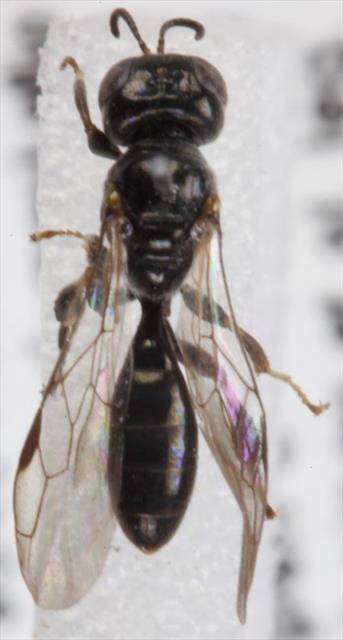
Crossocerus styrius
N/A
NHMSYS0000875804
RecommendedWell-formed
N/A
crsty
(Kohl, 1892)
Insect - hymenopteran
Species
1
1
1
08/08/2022
08/08/2022
17 May (recorded in 1998)
8 August (recorded in 2022)
Collated by the National Biodiversity Data Centre from different sources, General Biodiversity Records from Ireland, National Biodiversity Data Centre, Ireland, Crossocerus styrius, accessed 08 July 2026, https://maps.biodiversityireland.ie/Dataset/7/Species/56304