Species Detail - Brachyptera risi - Species information displayed is based on the dataset "A national macroinvertebrate dataset collected for the biomonitoring of Ireland’s river network, 2007–2018 (EPA)".
Terrestrial Map - 10km
Terrestrial Map - 10km
Distribution of the number of records recorded within each 10km grid square (ITM).Marine Map - 50km
Marine Map - 50km
Distribution of the number of records recorded within each 50km grid square (WGS84).
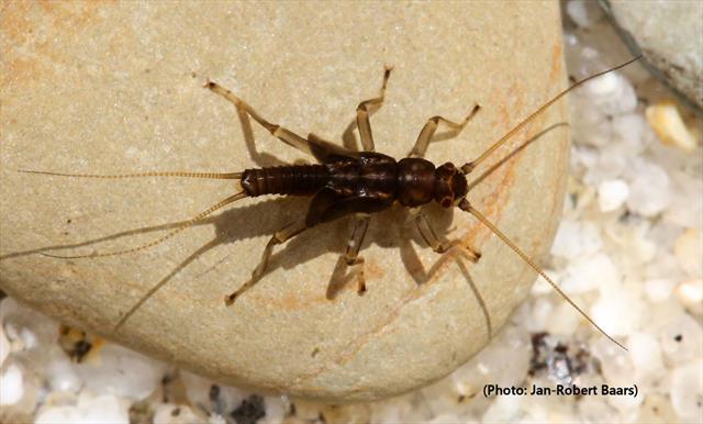
Brachyptera risi
N/A
NBNSYS0000022414
RecommendedWell-formed
N/A
brris
(Morton, 1896)
Insect - stonefly (Plecoptera)
Species
5
4
4
10/06/2014
27/06/2017
1 January (recorded in 1929)
17 December (recorded in 2012)
Environmental Protection Agency, A national macroinvertebrate dataset collected for the biomonitoring of Ireland’s river network, 2007–2018 (EPA), National Biodiversity Data Centre, Ireland, Brachyptera risi, accessed 20 July 2026, https://maps.biodiversityireland.ie/Dataset/335/Species/184705